
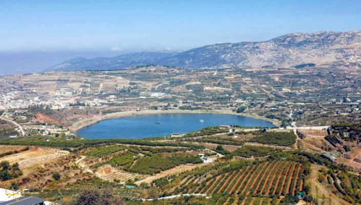
Repeated incursions, the expansion of military infrastructure, and continued pressure on areas near the separation line are all indications of a change in the nature of Israel's deployment in southern Syria.
Afrasianet - Menhal Parish - Israel's movements in southern Syria go beyond the limits of limited military incursions, revealing a path toward establishing new realities on the ground in the vicinity of the occupied Golan and the foothills of Jabal al-Sheikh. The bombing, which targeted a site near Jandal Castle in the Damascus countryside on September 20, comes in a context in which Israeli security calculations overlap with military geography and the memory of previous wars, while road construction and fortification work continues in the Quneitra countryside, leading to the project known as "Suva 53".
The area of Jandal Castle derives its importance from its location on the western slopes of Jabal al-Sheikh, which overlooks large areas of southern Syria and parts of Lebanon and the Golan. Since the October 1973 war, these heights have occupied a central position in Syrian and Israeli military calculations, given their capability to provide monitoring, early warning and supervision of the axes of movement in the region. Therefore, any military movement in its vicinity cannot be separated from the competition for control of the geographical area around it.
The incident near the Jandal fortress raises questions about the nature of the Israeli deployment in the area, the limits of the movement of Israeli forces outside the ceasefire line, and the function of the new military positions in the vicinity of the capital, Damascus. However, linking the incident to a specific operational objective or considering it as part of an integrated Israeli plan requires additional field data, and it is not enough to coincide with other military movements.
The October 1973 war occupies a prominent place in Israel's military memory, particularly the battles that took place on Mount El-Sheikh during the early days of the war. The mountain was a strategic location that both sides sought to control.
Israeli military ceremonies associated with these battles conjure up lessons related to military surprise, the importance of high-altitude control, and the role of advanced positions in early warning and defense systems.
A commemoration ceremony for those killed in the battle of Jabal al-Sheikh was held on September 15th, while the site was bombed near Jandal fort five days later.
From the line of defense to the expansion of the security sphere
One of the pillars of Israel's military thinking in the Golan is to prevent the adversary from approaching vital sites, and to provide greater monitoring, action, and rapid response capability.
This approach has taken on a new dimension with the transformations that Syria has seen since December 2024, Israeli advances to positions within the separation zone, as well as the establishment of military sites and the implementation of engineering works in parts of the south of the country.
In this context, the statements of Israeli Prime Minister Benjamin Netanyahu and Defense Minister Yisrael Katz on the need to ensure Israeli security in the southern Syria, and the retention of strategic positions in the region. These positions reflect a trend toward linking the security of the Golan to a broader military presence inside Syrian territory, while seeking to prevent any Syrian military deployment that Israel could view as a threat to its positions.
This policy raises questions beyond border security. The wider the scope of Israel's deployment, the more space Damascus has to deal with as part of the sovereignty file and regain control. The retreat from new positions becomes more complicated when they are backed up by military roads, trenches, earthen berms, and observation posts, installations that can give a more stable military presence.
This does not mean that all Israeli moves necessarily proceed from a single plan or are subject to a unified operational command in all areas. Taken together, repeated incursions, expanded military infrastructure, and continued pressure on areas near the separation line are indications of a change in the nature of Israel's deployment in southern Syria.
The Suva 53 project represents one of the most prominent manifestations of this transformation in the Quneitra countryside. It is an Israeli engineering and military project that is being implemented inside Syrian territory, along the separation line with the occupied Golan, within the area covered by the 1974 Separation of Forces Agreement.
The project consists of a road dedicated to the movement of military vehicles, eight meters wide, and is bordered by earthen berms that rise in some sections up to about five meters, and are distributed along trenches, observatories, and fortified positions. The 70-kilometer number is circulating along the length of the project, without clarifying whether it measures what has actually been built on the ground or the entire route as planned.
The route cuts through the Quneitra governorate from north to south, as it started at the foothills of Jabal al-Sheikh, in the vicinity of Hadar and west of Ain al-Tineh, then passed through the lands of Jabata al-Khab, al-Hamidiya, al-Hurriya and al-Qahtaniya, and headed south through Ruwaihina, Bir Ajam and Brega towards al-Asha and the area where the Syrian and Jordanian borders meet the occupied Golan.
Local residents told Al-Quds Al-Arabi that bulldozers and heavy machinery returned on 4 October 2026 to the western outskirts of the village of al-Asha, and to the southwest of the town of al-Rafid, where the earthworks were expanded and new trenches were dug up.
This route indicates that the project is not limited to the construction of a road for the movement of vehicles, but also allows for the enhancement of longitudinal military movement, facilitating surveillance and positioning, and linking different sites within a field axis that extends from the north of Quneitra to its south.
The name is likely taken from the 53rd Armored Battalion of the 188th Brigade, a battalion nicknamed "Suva," meaning "storm" in Hebrew. Israel presents the project within the framework of security, defense and protection needs and the protection of the residents of the Golan, while Damascus rejects it.
Local reports say that excavation and dredging work have damaged agricultural lands, pastures and vegetation in a number of villages, impeding access to their lands by some farmers, as well as affecting rainwater runoff. Previous local statements estimated the affected areas at thousands of dunams, while Anadolu Agency reported in May 2026 an estimate of about 12,000 dunums in parts of the Quneitra countryside. These figures need to be read carefully, as the area affected does not necessarily mean that all of them have been confiscated or taken out of agricultural use altogether.
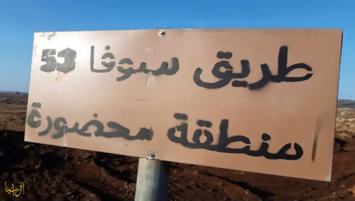
The Sofa 53 project is based on the construction of a road about 8 meters wide
Geographically, Suva 53 has no border or legal status, as it is a military field facility unilaterally established by Israel within the separation zone drawn by the 1974 agreement and entrusted to the United Nations Disengagement Observer Force (UNDOF). The distance between parts of the project and the ceasefire line varies depending on location, with reports of stretches ranging from hundreds of meters to about two kilometers at some points, details that need to be verified by reliable field maps.
The broader significance of the project is that it could be transformed from a military road into a connected network of fortifications and observation points, establishing a field presence that is difficult to treat as a transient movement.
The 1974 Agreement Under Pressure
The Syrian Ministry of Foreign Affairs condemned the resumption of excavation and bulldozing work, and considered the project a violation of the 1974 Separation of Forces Agreement and Syrian sovereignty, calling on the international community to shoulder its responsibilities.
Arab countries, including Jordan, Qatar and Kuwait, have also issued positions rejecting Israeli moves, at a time when there are continuing fears that engineering work will become a permanent military reality.
The extent to which each facility or section of the road violates the arrangements contained in the 1974 Agreement remains linked to its exact location and the nature of the activity taking place therein. However, the implementation of military actions within the buffer zone, the continuation of incursions and the establishment of fortifications put the Agreement to a practical test related to the ability of the United Nations and the parties concerned to prevent unilateral changes on the ground.
The importance of Israeli movements is not limited to Quneitra alone, as the geography of southern Syria is linked to a network of roads and axes that connect the area to the capital Damascus and to the Lebanese and Jordanian borders. The location of Jabal al-Sheikh and the surrounding heights gives special importance to this network, given its supervision of the axes of movement between the Golan and the western countryside of Damascus, and on roads connecting Damascus to Beirut through Syrian territory.
The advance to the vicinity of Qalaat Jandal, in parallel with the continuation of fortification work in Quneitra, raises questions about the extent of the area that Israel seeks to monitor or influence. This illustrates how expanding deployment at various points could alter the security environment in southern Syria and increase pressure on the routes of movement and communication between areas.
Suwayda, Daraa, and Quneitra stand out not as identical arenas in military and political terms, but as areas where the fragility of the security situation, the challenges of rebuilding state institutions, and foreign interventions intersect. Continued Israeli incursions give Damascus a narrower margin for reentry Arrange their military deployment in the south, while locals bear part of the cost through damage to farmland, restricted movement, and continued uncertainty about the future of their areas.
The occupied Golan remains central to Israel's security perception, and the restoration of sovereignty over it remains part of the Syrian position.
Israel links its actions to preventing the threat, and Damascus sees the deployment within its territory and the new fortifications as perpetuating a reality that goes beyond the separation arrangements.
Between a location near the Damascus countryside and a fortified road in Quneitra, Damascus faces simultaneous challenges: protecting sovereignty, establishing a ceasefire, rebuilding defensive capacity, and preventing sporadic movements from becoming permanent facts.
The question is whether these fortifications will remain tied to stated security considerations, or whether they will be transformed into a structure that imposes conditions on any future settlement. Every new road, every trench or berm within the separation zone, does not only change the shape of the land; it also raises the question of the actual limits of sovereignty, and the ability of the 1974 arrangements to prevent the imposition of a new reality by force.
________________

